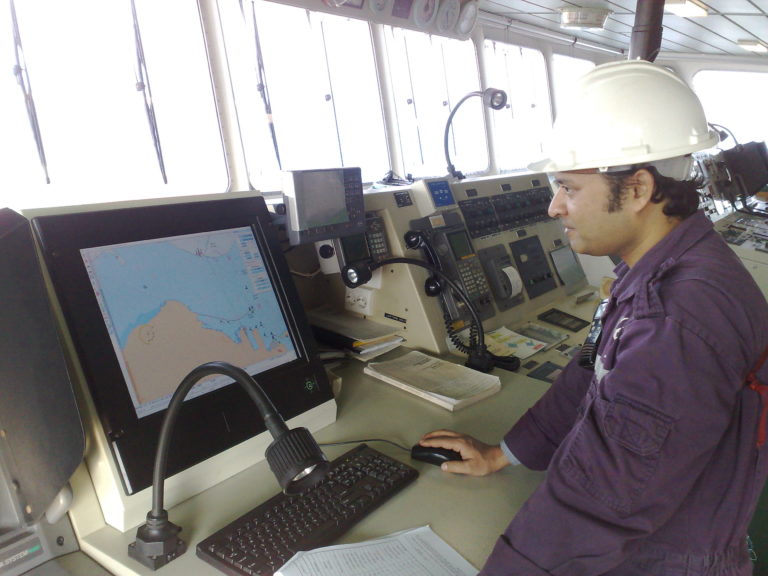
TOTEM ECDIS- Electronic Chart Display & Information System
The only ECDIS with a decision support tool (DST) for collision avoidance at sea.
Advice complying with the international regulations for preventing collisions at sea

Totem ECDIS unique features were design to enhance SAFETY on board ships:
- Collision Avoidance: A revolutionary Decision Support Tool (DST) complying with COLERGS. The system not only alerts the Master or OOW to the risk of collision,
but also advises the best course or speed change needed in order to avoid collision.
The advice given is in accordance with the legal requirements of the International Regulations for Preventing Collisions at Sea 1972 (COLREGS).
All the information is calculated automatically for all targets and is continuously refreshed and updated. - EDA: History files can be analyzed by E-navigation Data Audit program to detect near miss events (EDA free copy is available with Every ECDIS).
EDA can allow proper auditing on how the bridge team is performing and assist in monitoring the performance of the vessel. - GPS validation: To avoid GPS spoofing, Totem ECDIS is monitoring the difference between DR and GPS positions at all times,
and issues an alarm if the difference within a set time, exceeds the set allowed distance. - Watch Take Over: The watch take over procedure, implemented by every officer commencing a watch on the bridge,
gives the OOW a clear picture of the system functionality.
The procedure ascertains that the system is configured and working properly, sensors information is correct, correct charts are available, license is valid etc.
The procedure is logged for future auditing. - AIS update and AIS messages: Totem ECDIS enables direct updating of AIS from the ECDIS, sending and receiving AIS messages by the ECDIS using full keyboard capability.
This feature was designed to make this operation simple and friendly. - Multilingual: Totem ECDIS has multi-lingual capabilities, and besides English (which is the main language) can change the menu to several other languages of choice.
- Radar Overlay: Totem ECDIS has the ability to connect two radars on a single radar overlay card.
- Planning station or Captain’s ECDIS : A third PC can be connected to the Dual ECDIS by LAN, as a planning station,
and receive the serial information over LAN from the Dual ECDIS (no need for dedicated serial interface) (Optional) - ECDIS screens are transferred by LAN to VDR according to IEC61162-450
Totem ECDIS complies fully with the following:IMO Resolutions: IHO Standards IEC Standards MSC 191(79) S-57 Edition 3.1 (November 2000) IEC 61174 Ed. 4.0 (2015) A.694(17) S-52 Edition 6.1(.1) (October 2014 With Clarifications up to June 2015 IEC 60945 (2002) MSC.232(82) PresLib Edition 4.0(.1) (Annex A to S-52)
(October 2014 – With Clarifications up to June 2015)IEC 61162-1 (2016) S-64 Edition 3.0.1 (June 2015) IEC 62288 ed. 2.0 (2014) S-63 Edition 1.2.0 (January 2015) IEC 61162-450 Ed. 1
Totem ECDIS Functionality
The following functionalities are included in Totem ECDIS:
- AIS & ARPA targets overlay
- Easy and simple chart updating using direct internet connection, Email or offline updating
Totem ECDIS can interface with:
Mandatory
- GPS/DGPS navigation receiver
- Gyrocompass
- Speed log
Important
- AIS
- Radar – ARPA (Radar Overlay optional)
- Echo sounder
Nice to have
- Anemometer
- VDR
- BNWAS
- Navtex
- BAMS
Track Control
Totem ECDIS is approved by DNV-GL as Track Control system, together with Raytheon Anschutz or Yokogawa Auto pilots.
The new Track Control system is designed to keep the vessel on a selected pre-determined route with unlimited number of waypoints.
Electronic Charts
- Totem ECDIS supports the following electronic charts format:
- C-MAP ENC (Jepessen) charts CM93/3 and Official Database (Jepessen Primar; ENC)
- IHO S-57 and IHO S-63 charts (ENCs) (Admiralty, Primar and more).
- Totem ECDIS is compatible with the Admiralty Information Overlay (AIO), the digital version of Admiralty Notices to Mariners.
Within the Totem ECDIS the AIO display is a mariner selectable feature that can be easily switched on and off. - Charts subscription can be purchased directly from the provider or from Totem Plus, according to owner preferences.


